Geospatial Engineering
CESL-GSEU Provides precise and reliable solutions for clients by using 21st-century High-end equipment and experts in surveying and mapping. Our Geospatial engineers often work as surveyors, to create models that can easily be interpreted by analyzing the land using Geospatial Technology currently available in the world. To achieve this, we utilize a variety of tools, including satellite imagery and drones/LiDAR, to examine the topography of the Earth and also we develop Engineer’s Capacity on Geospatial Science for inspection of highways, bridges, roads, cell towers, high mast lighting, wind turbines, power transmission lines, building façade and roof, survey and mapping, construction monitoring, wetland/environmental, drainage and erosion, traffic monitoring, emergency services.
Key Words: Civil Engineering, Surveying, Geophysics, Geography, Computer science, Earth sciences, Geodesy, Geomatics, Environmental Science, Climatology, Hydrology
To pioneer geospatial engineering excellence through innovative technologies and sustainable practices, aligning with CESL's commitment to industry leadership.
To achieve excellence in geospatial engineering by integrating advanced technologies and innovative processes and researches, while empowering and recognizing our highly motivated and trained staff.
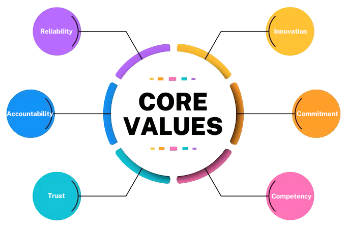
Following Core Values are the set of ethics and principles that govern Geospatial Engineering unit's decision-making and actions.
CESL geospatial technologies and engineering support services help our customers understand, analyze, and manage a wide range of challenges in the surveying (under ground and above ground), mapping, modelling, professional development, consultation and innovation of the geospatial industry in the world.
LiDAR Drone Arial Surveying and Mapping
Topographic Survey
Geomatic Services
DGPS Services
Underground Utility Locating and Mapping
Electromagnetic Sub-Surface Investigation and Modelling
2D and 3D Lacer scanning and Modelling
Training and Development
Hydrographic Survey
Consultation
Environmental Assessments
Research and Development
Application Development
Transient Electromagnetic Geophysical Services
We use and provide services with all 21st Century Geospatial Technology tool available in the world and bring you customize solution for your requirement.
1. Geographic Information Services (GIS) data development and analysis
2. Surveying and Mapping
3. GPS/DGPS Technology
4. Electro Magnetic Technology (GPR,TEM)
5. Remote Sensing
6. Information Communication Technology
A Geographical Information System (GIS) is a system for analyzing, storing, and presenting all types of data. Because of its capacity to combine database technology and perform statistical analysis, GIS has been widely employed in civil engineering. With all the demands on your time, using tools that streamline your business processes and provide you with the best mapping and visualization makes sense. GIS can help you present information in a straightforward way to partners in your projects, government officials, and the public. We are providing services on GIS for more efficient.

We are providing services on above and underground survey.
ABOVE GROUND

UNDER GROUND


We are a leading service provider of DGPS surveys and all types of land surveys.Our Equipment are more enhanced accurate solution with dual frequency, RTK Differential Global Positioning System (DGPS) Receiver with accuracy in static mode with accuracy of;
Horizontal = +/- 5 mm + 0.5 ppm RMS
AND
Vertical = +/- 5 mm + 1 ppm RMS
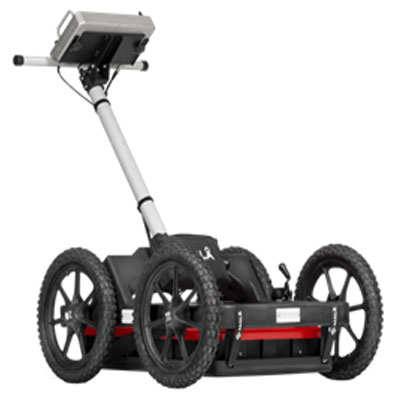
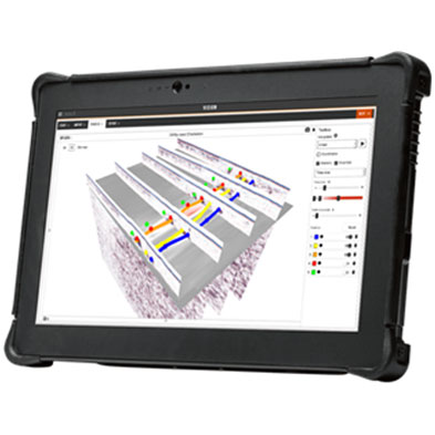
We have several major electromagnetic technologies that can be used for high-quality, intelligent ground penetrating radar for utility locating, Transient Electromagnetic geophysical Solutions.
Ground Penetration Radar (GPR)
Transient Electromagnetic geophysical Solutions
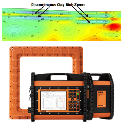
We are ready to provide most advanced TEM (Transient Electromagnetic) which is geophysical technique used to obtain vertical resistivity soundings and a method which responds most strongly to conductive materials.
TEM is an effective way to map changes within rock or soil, for example, clayey layers restricting groundwater flow, conductive leachate in groundwater, and seepage in earthen embankments. It will provide more accurate data for mineral exploration, engineering, and environmental investigation.
TEM is perfectly suited to locating groundwater and minerals, but also useful for applications such as geological mapping and environmental surveys.
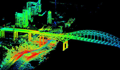
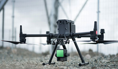
We have LIDAR Sensors which an active remote sensing technology with highly accurate position and attitude data are used to provide information on the elevation of various surfaces.
LiDAR Drone Services
3D Laser Scanning for Engineering and Architecture
Using a digital 3D scan for as-built information, engineers can design complicated retrofits and upgrades that fit the first time upon installation, avoiding costly and usually inevitable engineering errors or miscalculations. 3D scanning makes design work easier and allows engineers to work in a highly efficient manner.
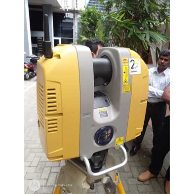
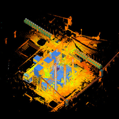
Capture precise as-built data, including all details of the layout and materials and directly into BIM. We built 2D plans, interior design, 3D modeling and integration with BIM (Building Information Modeling) technology, structure monitoring and interventions in existing structures.
CESL-GSEU can design and develop systems customized to our partners’ needs. Our team of application developers has provided design, development, and implementation of software applications for mobile, office, and web-based deployment.
Services include:
1. WEB and Desktop Application Development
2. Software Integration
3. Database Design
4. Training and Support
5. Data Conversion
6. Systems Integration
GIS technology in civil engineering has opened up new avenues for resolving environmental issues, lowering costs, and improving the quality of complex projects. However, GIS software can be operated from the inside, allowing for the usage of different data designs.
The main objectives of this service are on aligning and boosting innovation in the Geospatial ecosystem in line with improved governance, system efficiency, and widespread adoption across sectors for greater economic and social value. The focus is first on identifying key stakeholders and relevant institutions and on standardizing the capacity-building program content, ensuring delivery through 21st century geospatial technology, use of expert inputs as well as provision for a wide range of teaching-learning resources. Professional can develop their career ladder while developing their level of skills.

We designed our professional development program outlines the steps and resources an individual can use to achieve specific goals, acquire new skills, or expand their knowledge. It serves as a roadmap for continuous learning and personal growth.
1. Introduction to Geospatial Technology - Fundamental of GIS, GPS, RS.
2. GIS In Civil Engineering Applications (Structural, Environmental, Transportation, Wastewater/Stormwater, Site Analysis, Surveying, CAD Integration).
3. Modern Remote sensing Technology for Engineering Design - LiDAR for structural analysis, Drones, aircraft, and satellites and LiDAR drone for topographic mapping and Surveying.
4. Use and Apply Ground Penetrating Radar technology - Utility detection,Concrete scanning, Transportation infrastructure, Environmental & geotechnical, Exploration & mining, Education & research, Archaeology, Transient Electromagnetic, Teophysical survey.
5. GIS application in structural analysis - GIS applications merging 3D GIS maps with normal design techniques, use dynamic overlays and 3D models to check the problems.
6. Mobile and web-based GIS Application for field data collection and mapping - Open-Source Web and Mobile Application Development
7. GIS Application for Environment Impact Assessment